Northern Xinjiang: Sayram Lake, Kanas & What Nobody Tells You
11 - 22 May 2025
Northern Xinjiang is worth visiting if you're drawn to vast, remote landscapes and want to experience China's less-traveled regions. The journey covers iconic sites like Kanas Lake, Sayram Lake, and Urho Ghost City, but be prepared for long travel days (5-10 hours between cities), visible security checkpoints, and extreme UV exposure at high altitude. This region feels closer to Central Asia than eastern China in both landscape and culture.
“Want to go to Xinjiang?” my friend asked. I had to pause. I didn’t know exactly where it was, what it looked like, or why anyone would go there. So I did what any curious person would do — I Googled it.
The images that came back looked like Tibet crossed with Central Asia: mountainous terrain, open grasslands, nomad tents. I read a little more and understood just enough to say yes.
For most of those eleven days, I found myself in a tour bus watching vast stretches of bare, dry land roll past the window for hours. No postcard ever showed me that part. And somehow, that’s the part I kept thinking about.
This Northern Xinjiang travel guide covers eleven days across the region: what it actually looks like, what caught me off guard, and whether it's worth the journey.
What Is Northern Xinjiang Actually Like?
Northern Xinjiang doesn’t feel like the China most people picture. It feels far closer to Central Asia — in its landscape, its food, and the faces of the people you pass on the street.
Xinjiang is home to many ethnic groups but is predominantly Muslim, with Uyghurs being the largest group, followed by Han Chinese, Hui, Kazakhs, Kyrgyz, Mongols, Tajiks, and others. You notice it quickly: menus lean heavily on lamb and beef rather than pork, mosques appear alongside the more familiar Chinese architecture, and the overall atmosphere has a cultural texture that feels distinct from eastern China.
Here’s what the region actually covers, for context:
Located in northwest China, bordering Kazakhstan, Kyrgyzstan, Russia, Mongolia, Afghanistan, Pakistan, India, and Tajikistan
Geographically classified as a dry steppe in the north — not a desert, though it looks like one
Only a small fraction of the land is fit for human habitation — the rest is mountain, steppe, and bare terrain
The main religion is Islam, most prominently among the Uyghur community
I went in May, at the tail end of spring. Days were long — sunset stretched past 9:30pm, sometimes close to 10pm, with sunrise around 6:30am. The light was extraordinary. The UV, however, was brutal. Come prepared.

Sunset at 9.50pm
The Bare Land Nobody Photographs
Every Xinjiang travel post you’ll find online leads with Kanas Lake, the colourful hills of Rainbow Beach, or the sweeping grasslands of Nalati. Those places are genuinely stunning — I’ll get to them.
But what I wasn’t prepared for was the land between those places.
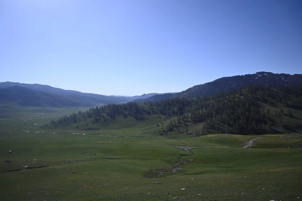
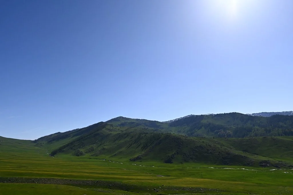
Northern Xinjiang is vast. Cities are 5 to 10 hours apart by road. And for most of those hours, the view from the bus window is the same: bare, dry, ochre-coloured steppe rolling out in every direction, with almost nothing interrupting it. No trees. Minimal vegetation. Just land and sky.
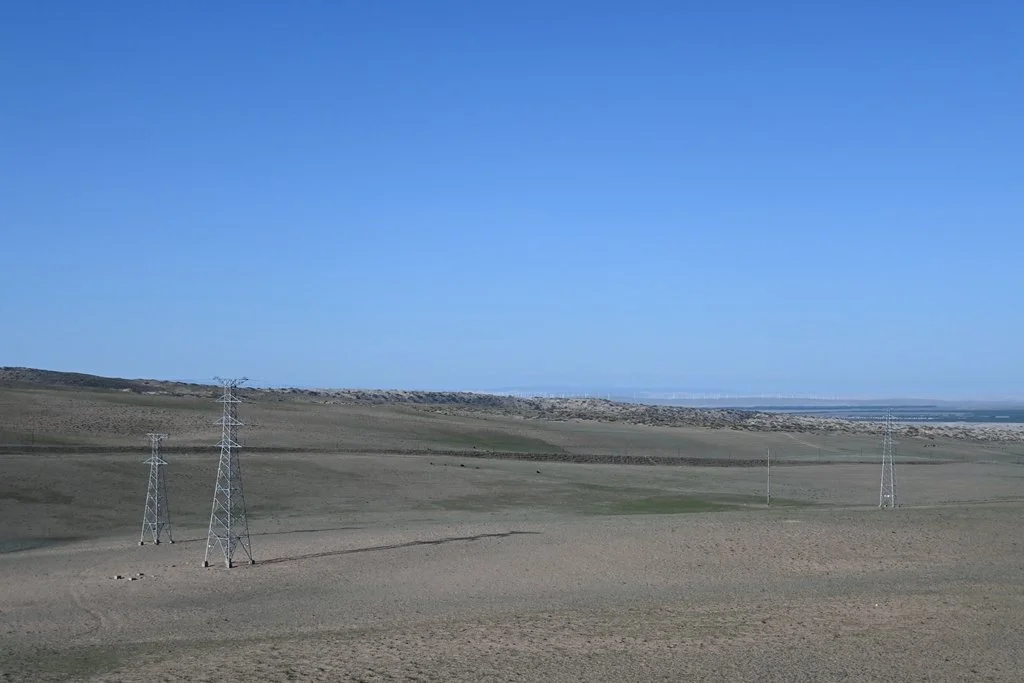
What you do see, occasionally, are large livestock farms — cows, goats, and camels fenced across wide open land. And wind turbines and solar power plants, more than you'd expect for a region this remote. Both feel oddly fitting out there — practical, quietly vast, built for a landscape that doesn't do anything small.
Scientifically, this is a dry steppe, not technically a desert. But to the eye, the distinction feels academic. It is one of the largest stretches of emptiness I have ever stared at. And I found myself unable to look away.
There’s something clarifying about landscape that just goes on and on. No signage, no services. The world doesn't seem particularly interested in being observed. By the time we reached each destination, the dramatic scenery felt earned in a way that a short flight would never give you.
If you’re planning a trip to Xinjiang, prepare yourself for this. It’s not a negative — it’s part of what makes the place feel real.
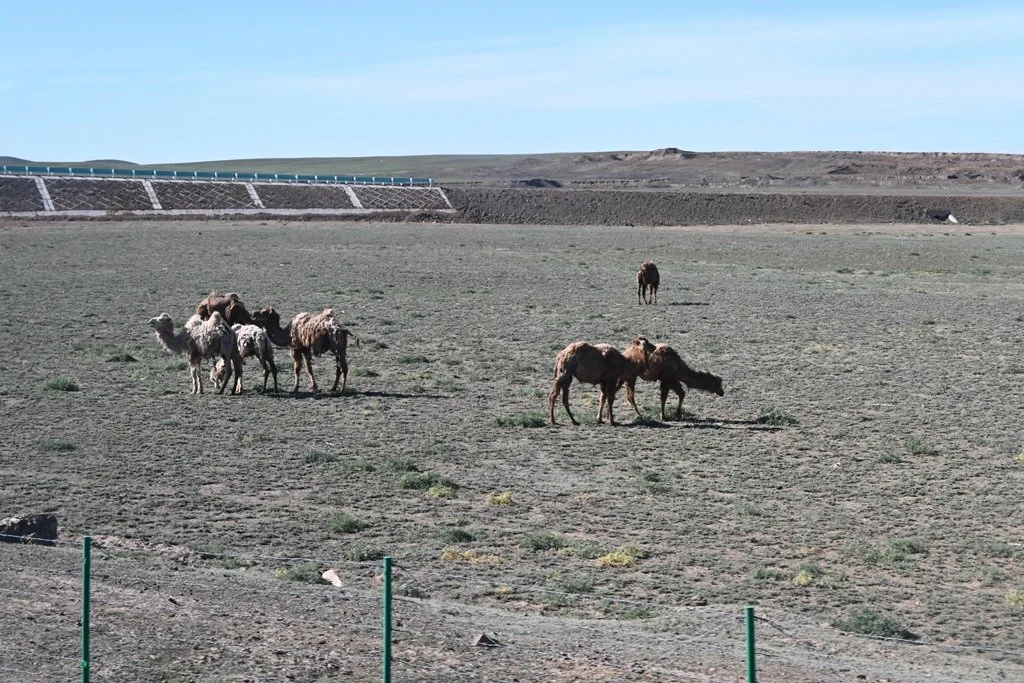
Livestock - camel
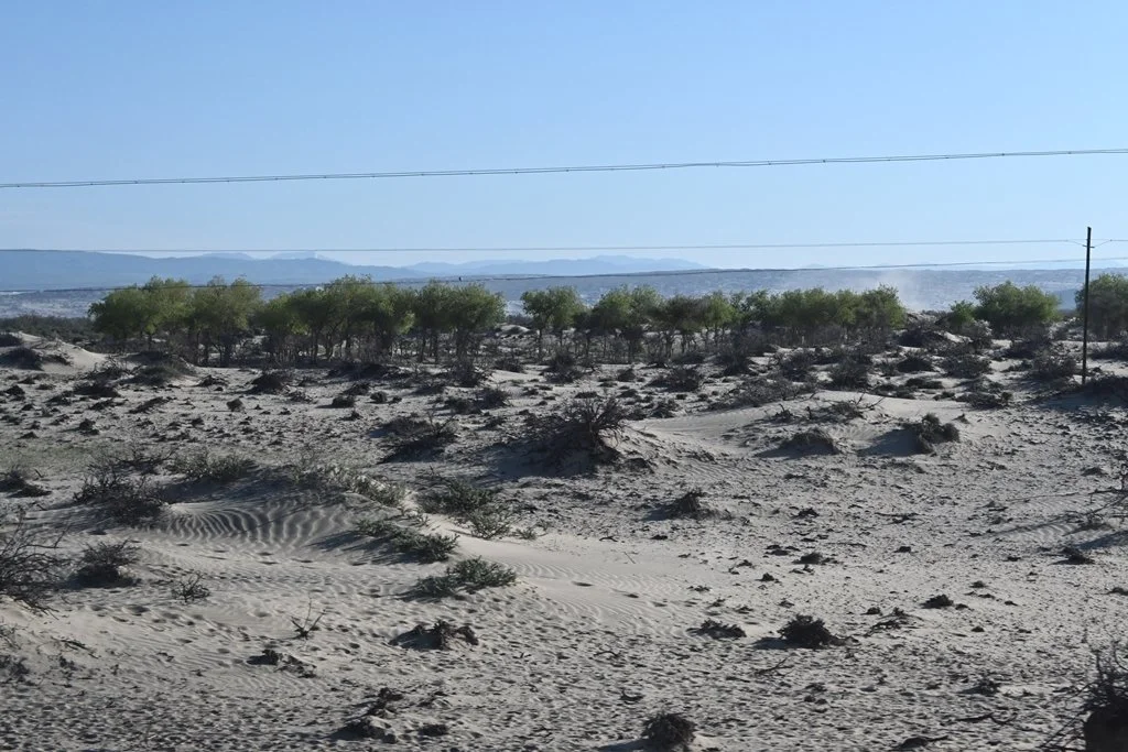
Bare land
Vast Bare land
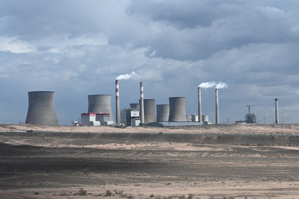
Factory in bare land
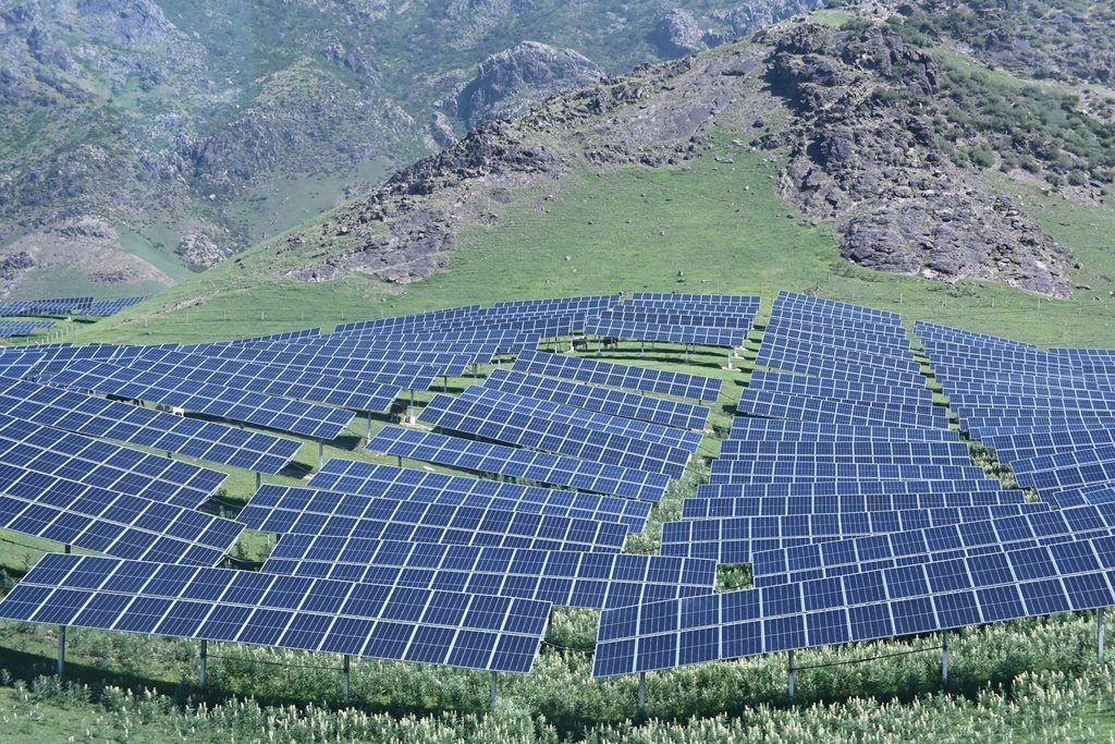
Large solar power plant
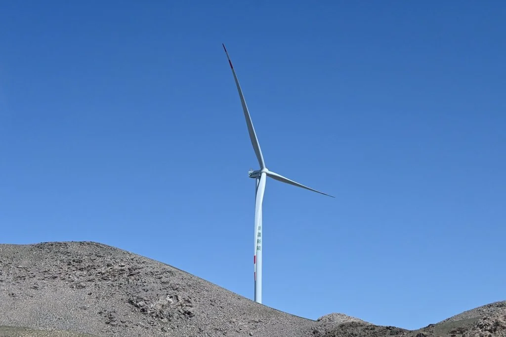
Wind turbine
What You Should Know Before You Go
A few things caught me off guard, and I think they’re worth knowing ahead of time:
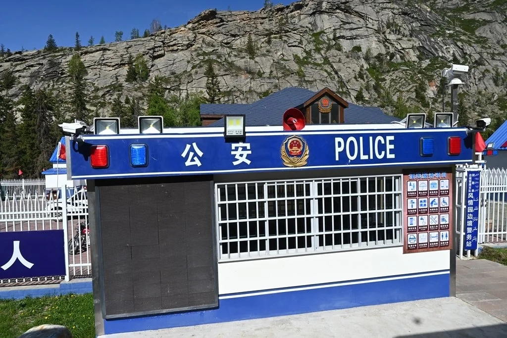
Surveillance is visible and constant
There are police checkpoints throughout the region. Our tour guide reminded us regularly to behave, stay seated, and keep seatbelts on. Petrol stations are heavily barricaded and fenced with barbed wire, with physical security checks before entry. I didn’t ask why — partly the language barrier, partly because it felt like an obvious non-question. This is the reality of travel in Xinjiang, and you should know it before you go.
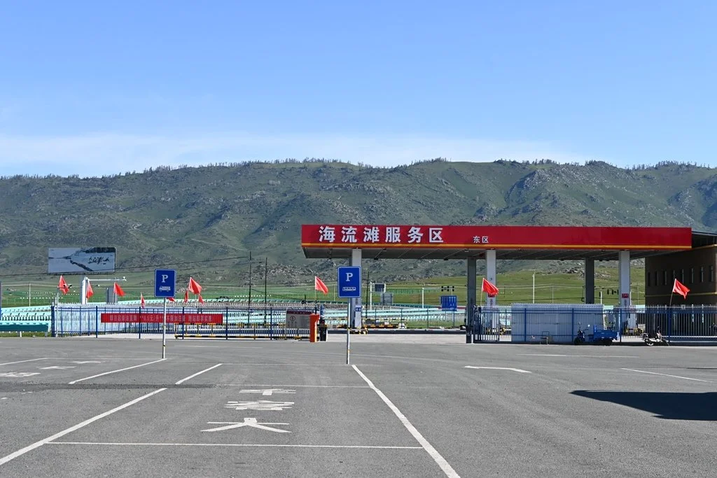
Petrol Station Barricade
Road regulations are strictly enforced
This surprised me more than the checkpoints did. Seatbelts are mandatory. Speed limits are enforced. And bus drivers are required to stop every two hours for a 20-minute rest. Coming from a memory of China a decade ago when these things felt loosely observed, the level of discipline was noticeable. I’m not complaining — on a long journey, I appreciated knowing the driver was being looked after.
The UV is extreme
Xinjiang is high-altitude and remote from marine weather systems. The ultraviolet intensity is not something to underestimate. Sunscreen, a hat, and UV-protective clothing are not optional here.
The infrastructure will surprise you
I expected rural and basic. What I got was smart hotel toilets with auto-flush in cities far from Urumqi, impressive architecture, and one bridge — the Guozigou Bridge — that genuinely stopped me mid-conversation. More on that below.
Shopping is Chinese tour standard, even when they say otherwise
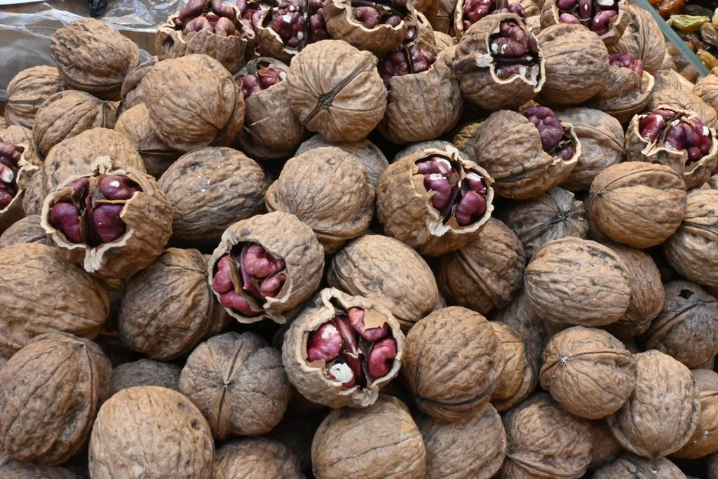
Our tour was advertised as no shopping stops. What we got instead was “bus shopping” — the guide circulating a form for Xinjiang-specific products: dried fruits, nuts, cheese snacks made from goat, cow, and camel milk. I bought some. The apricot-walnut ones were excellent. The cow milk cheese candy was an experience.
Where We Went: Cities and Stops Across Northern Xinjiang
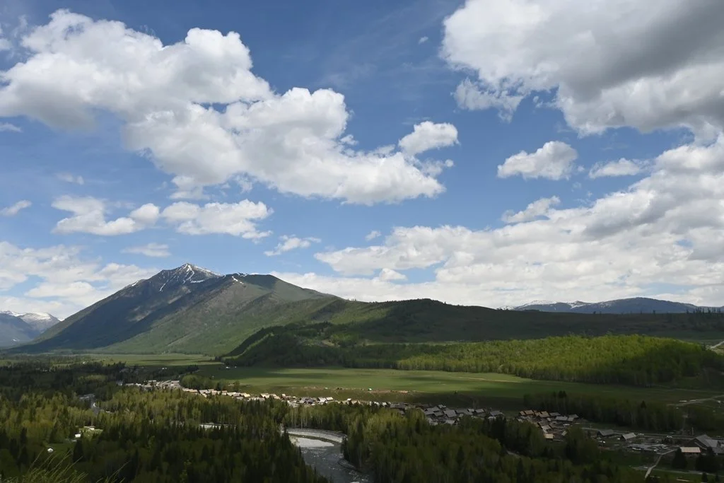
Our route: Urumqi → Fuyun → Burqin → Jiadengyu → Burqin → Kuytun → Yining → Nalati → Yining → Urumqi. Eleven days, a lot of road. Here’s what every stop in this Northern Xinjiang travel guide actually delivered.
Urumqi — Xinjiang’s Capital
Xinjiang’s capital and our base at the start and end of the trip. We visited the Xinjiang Ancient Ecological Park, which features preserved petrified wood and an Akhal-Teke horse base. The park’s purpose is to protect non-renewable palaeontological resources while making them accessible to visitors.
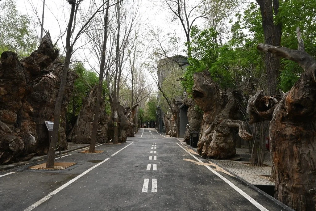
Xinjiang Ancient Ecological Park - Petrified wood
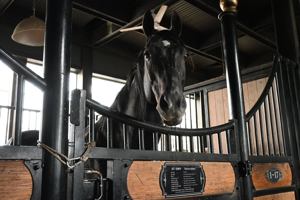
Xinjiang Ancient Ecological Park - Akhal-Teke horse base
Keketuohai UNESCO Geopark — Fuyun
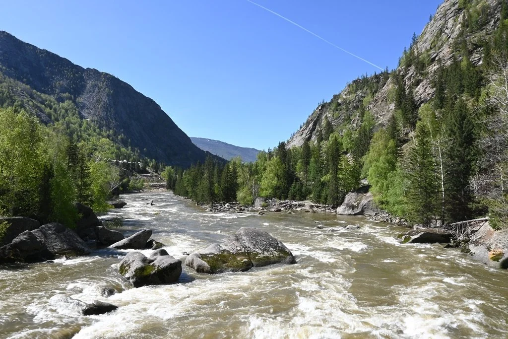
This was one of the quieter stops, but geologically fascinating. Keketuohai is known for its steep gorges, rivers, and unusual rock formations shaped by millions of years of erosion. The Kekesuli Lake sits within the park. If you’re interested in geology or you simply like landscapes that feel ancient and uncommon, this one lands differently than the scenic lakes further north.
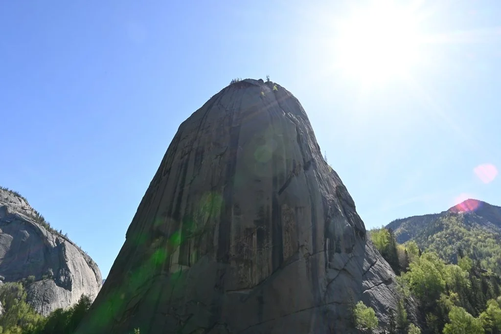
Keketuohai Unesco Global Geopark - Pictographic Rock Landform
Keketuohai Unesco Global Geopark
Keketuohai Unesco Global Geopark
Kekesuli Lake in Keketuohai Unesco Global Geopark
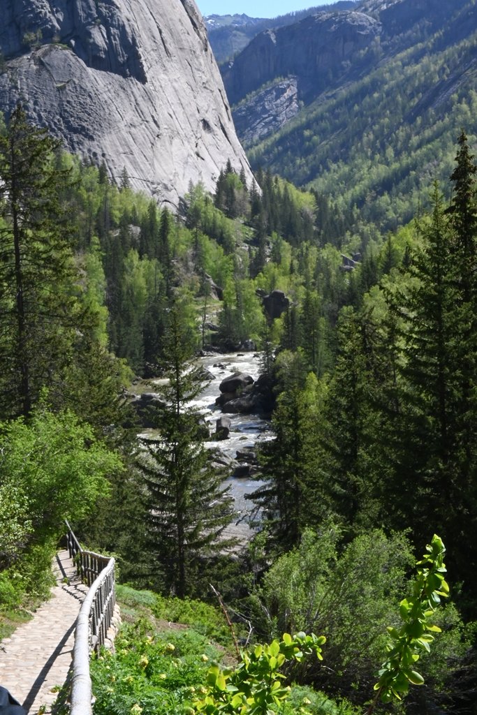
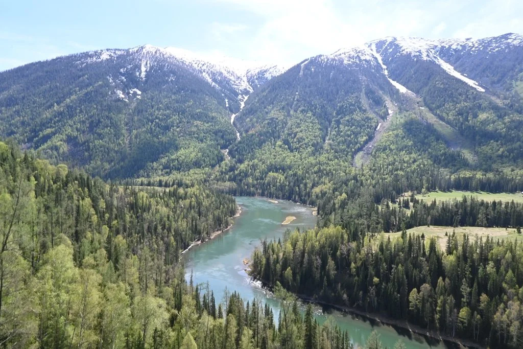
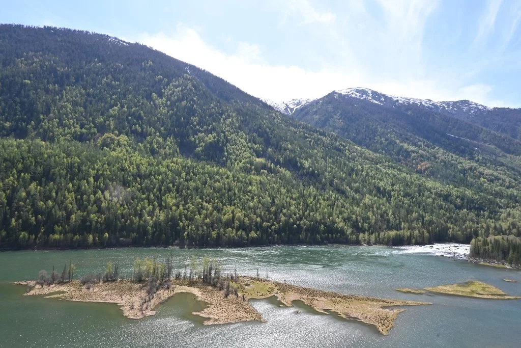
Kanas Scenic Area and Hemu Village — Burqin
This was a highlight of the trip for most people in our group. The Kanas Scenic Area sits in the Altai Mountains, at the point where China borders Kazakhstan, Russia, and Mongolia. We climbed 1,068 steps to reach the Fish Viewing Pavilion — the highest vantage point over Kanas Lake — and then worked through Wolong Bay, Moon Bay, and Immortal Bay.
Hemu Village was something else entirely. Named one of China’s most beautiful villages by National Geographic China in 2005, it’s one of the last remaining Tuva villages in the country. We walked through birch forests, visited the Tuva tribe settlement, and stood at the Haden Viewing Platform looking out over the Hemu River valley. The light in the late afternoon was the kind photographers plan whole trips around.
Kanas Scenic Area
Kanas Scenic Area
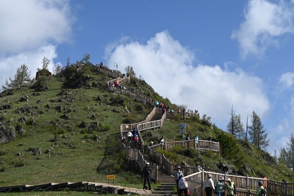
Fish Viewing Pavilion (Guanyu Pavilion) at Kanas Scenic Area
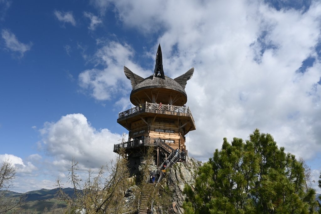
Fish Viewing Pavilion (Guanyu Pavilion) at Kanas Scenic Area - 1,068 steps to the top
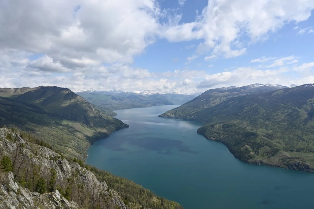
Kanas Lake
Kanas Scenic Area - Moon Bay
Kanas Scenic Area - Wolong Bay
Hemu Village
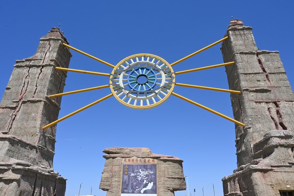
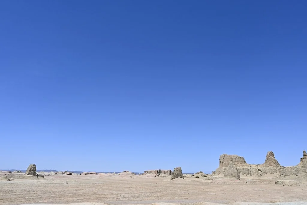
Urho Ghost City
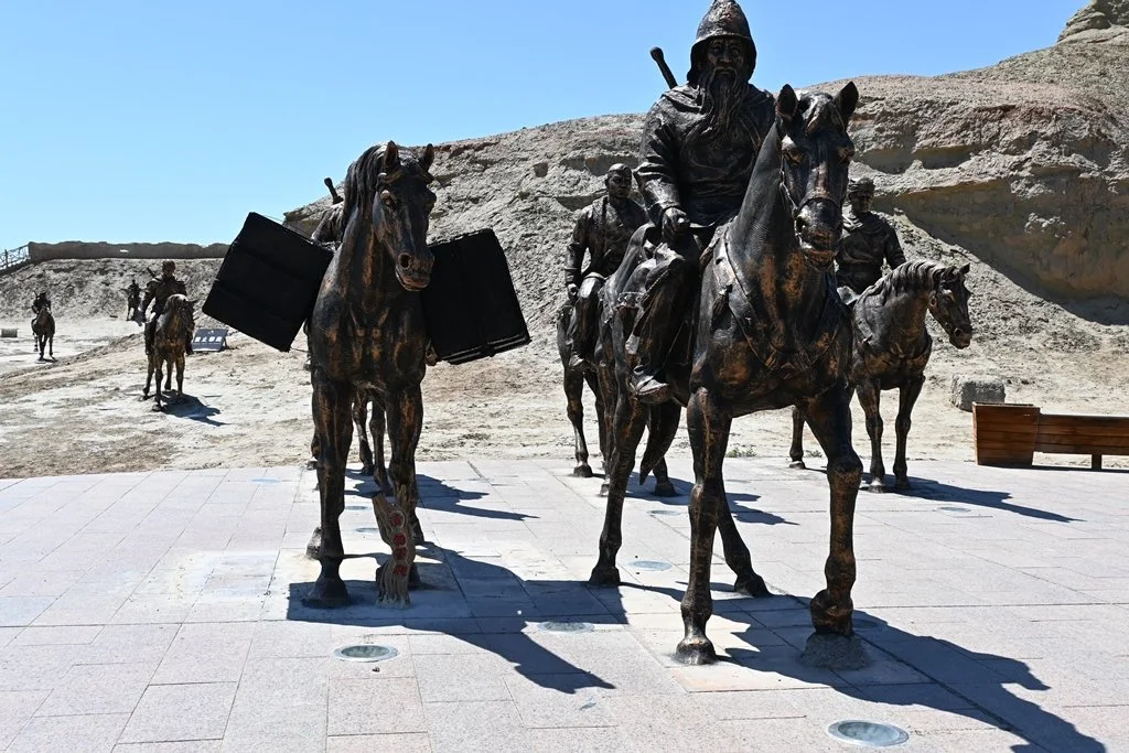
The formal name is the Wind-Eroded Geological Area in Urho District, Karamay City. Everyone calls it Ghost City, or Devil City. The name comes from the sound the wind makes passing through the rock formations at night — a low, unsettling howl that locals describe as ghostly. In daylight, the landscape looks like a ruined ancient settlement: formations that resemble castle walls, towers, animals, pavilions. It’s been used as a film location for Crouching Tiger Hidden Dragon, Seven Swords Descend from Heaven Mountain, and Hero by Zhang Yimou.
The area is large enough that we took a train ride through it rather than walking. On the way out, you can see the Baili Oilfield in the distance.
Urho Ghost City
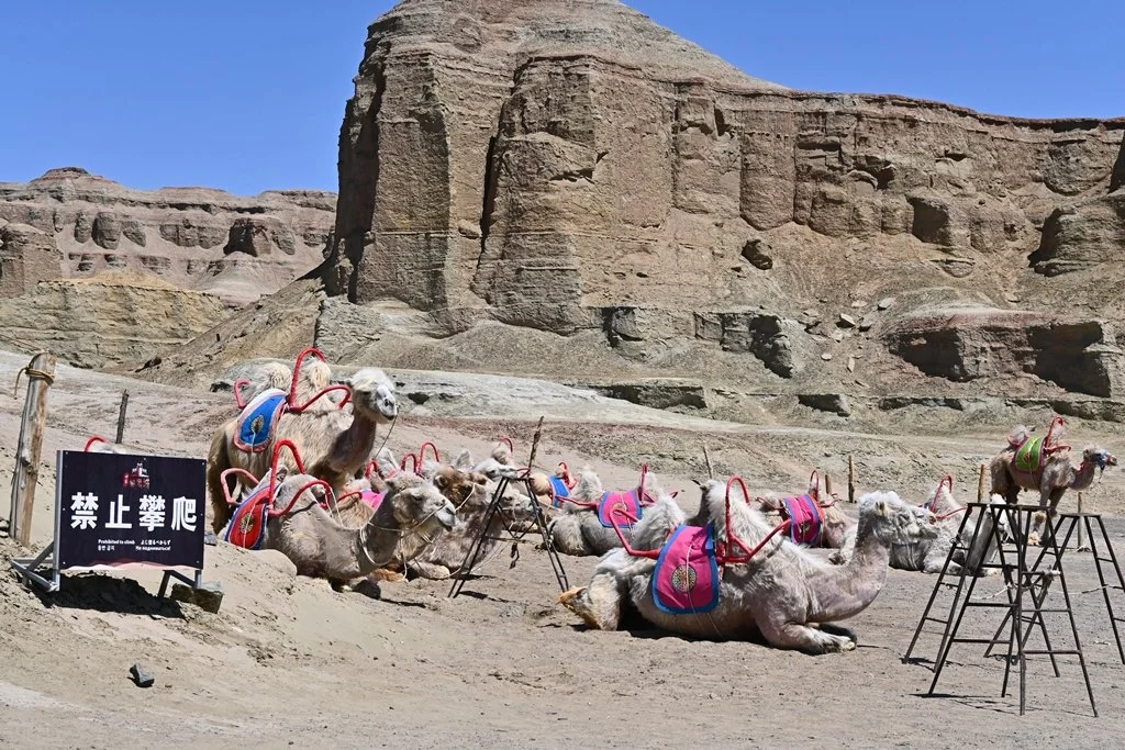
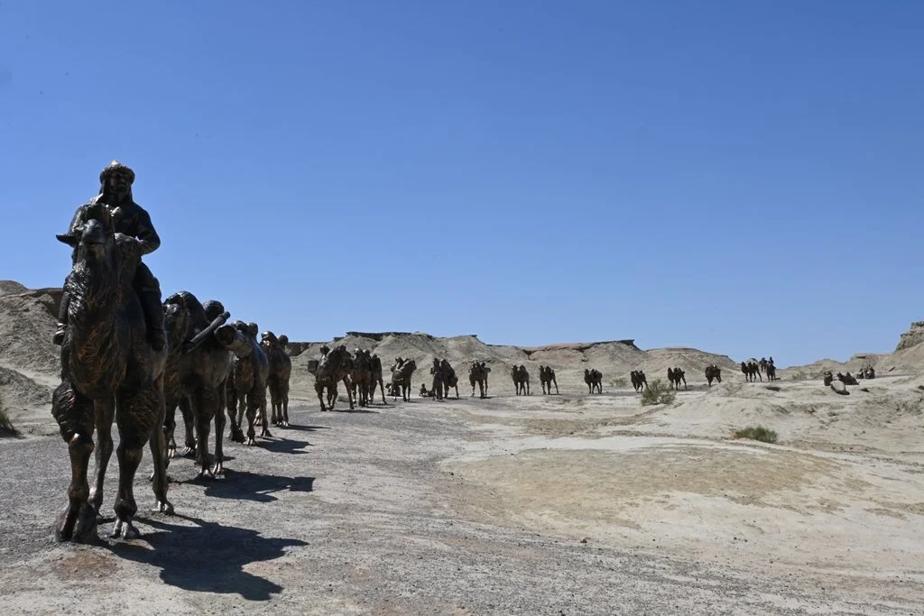
Urho Ghost City - Camel Ride
Urho Ghost City
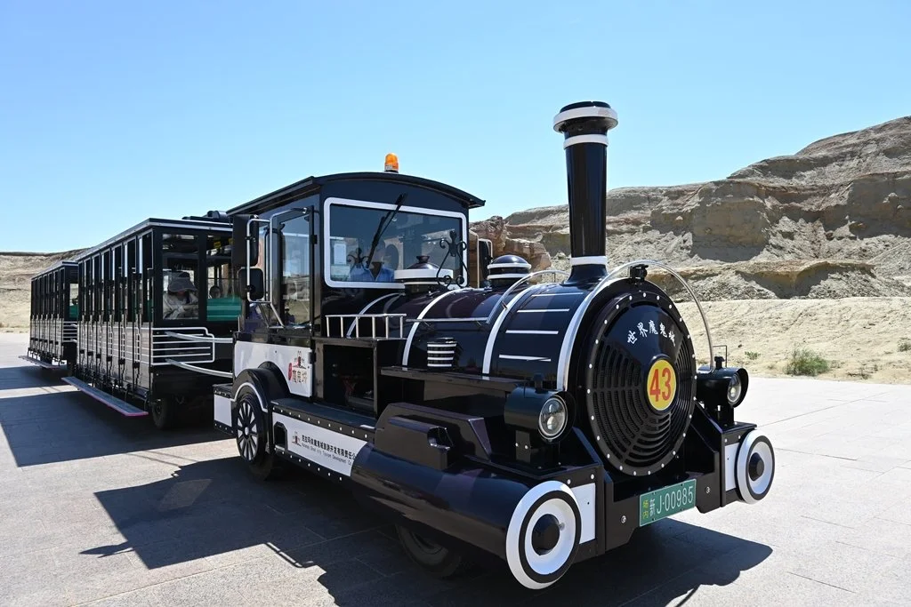
Urho Ghost City - Train Ride
Urho Ghost City - Filming location of the seven swords approach Tian Shan mountain
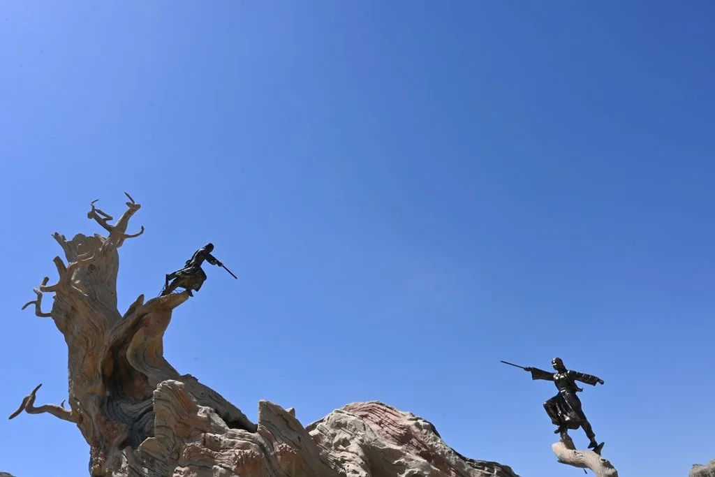
Urho Ghost City - Filming location for Crouching Tiger, Hidden Dragon
Urho Ghost City
Sayram Lake — The Last Tear of the Atlantic
At 2,073 metres elevation in the Tianshan Mountains, Sayram Lake is the largest alpine lake in Xinjiang. The local name for it translates loosely to “The Last Tear of the Atlantic” — a reference to the final moisture-carrying winds from the Atlantic that reach this far inland before the land becomes fully arid.
The water is clear, the surrounding grassland is green in late spring, and the panoramic views from the shoreline are the kind that make you want to just sit and not photograph anything. I photographed it anyway.
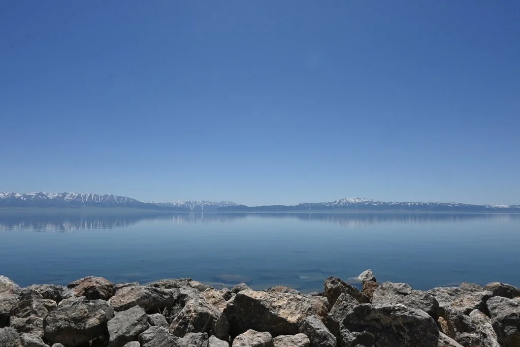
Sayram Lake
Guozigou Bridge — The One That Stopped Me
I was not prepared for this bridge.
The Guozigou Bridge (also called Talki Bridge) is a cable-stayed bridge with a 360-metre span, 180 metres above the valley floor. It opened in 2011 as part of the G30 Lianyungang–Khorgas Expressway in Huocheng County. Technically impressive by any standard. But what actually gets you is the approach: you come around a bend in a landscape of dry rock and mountain, and suddenly this structure appears. Clean, enormous, entirely out of nowhere.
Xinjiang doesn’t market itself as a place of architectural marvels. It probably should.
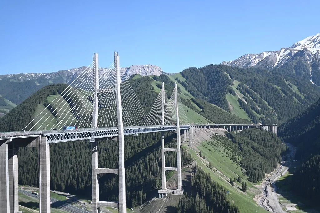
Guozigou Bridge
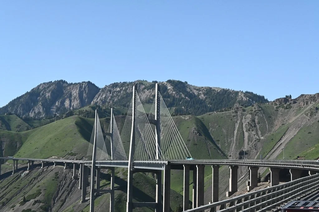
Guozigou Bridge
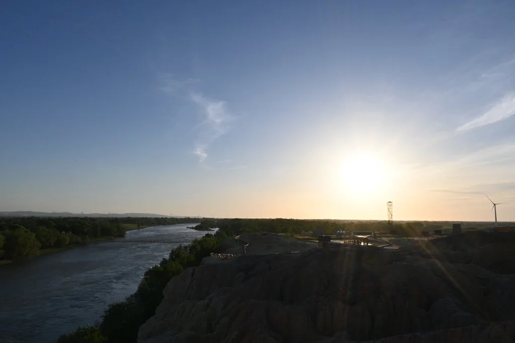
Rainbow Beach / Five Coloured Beach — Burqin
Located along the Irtysh River in Burqin County, Rainbow Beach is a stretch of wind-eroded hills in red, yellow, orange, and green — contrasted against the green riverside vegetation beside them. It’s a photographer’s stop, and the best time to be there is sunset, when the colours shift and deepen. Boardwalks run along the viewing area so you can move through the different colour bands.
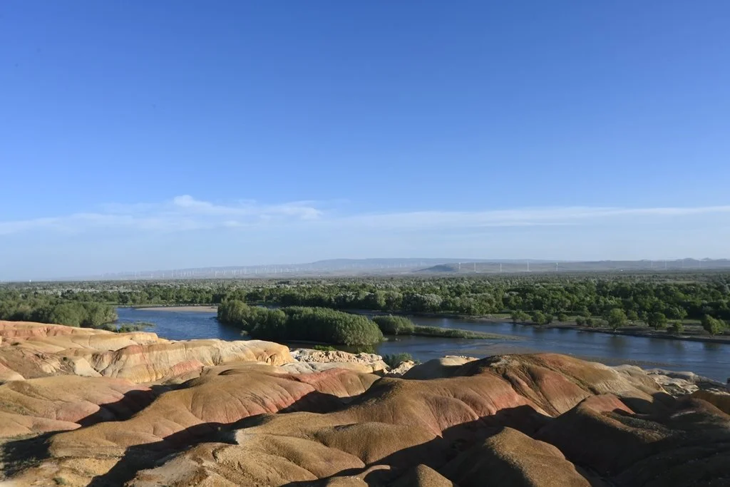
Rainbow Beach
Rainbow Beach
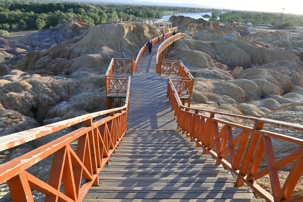
Rainbow Beach - Walkway
Rainbow Beach
Kazanqi Folk Tourism Area — Yining
Set in the old town of Yining, Kazanqi functions as a living museum of Uyghur traditional life. We arrived by horse-drawn six-pole carriage, visited traditional courtyard homes, watched local dance performances, and got a closer look at folk customs and architecture that are increasingly rare in the region. It’s a curated experience, yes — but an honest and respectful one. It felt less like a theme park and more like a neighbourhood that had decided to stay itself.
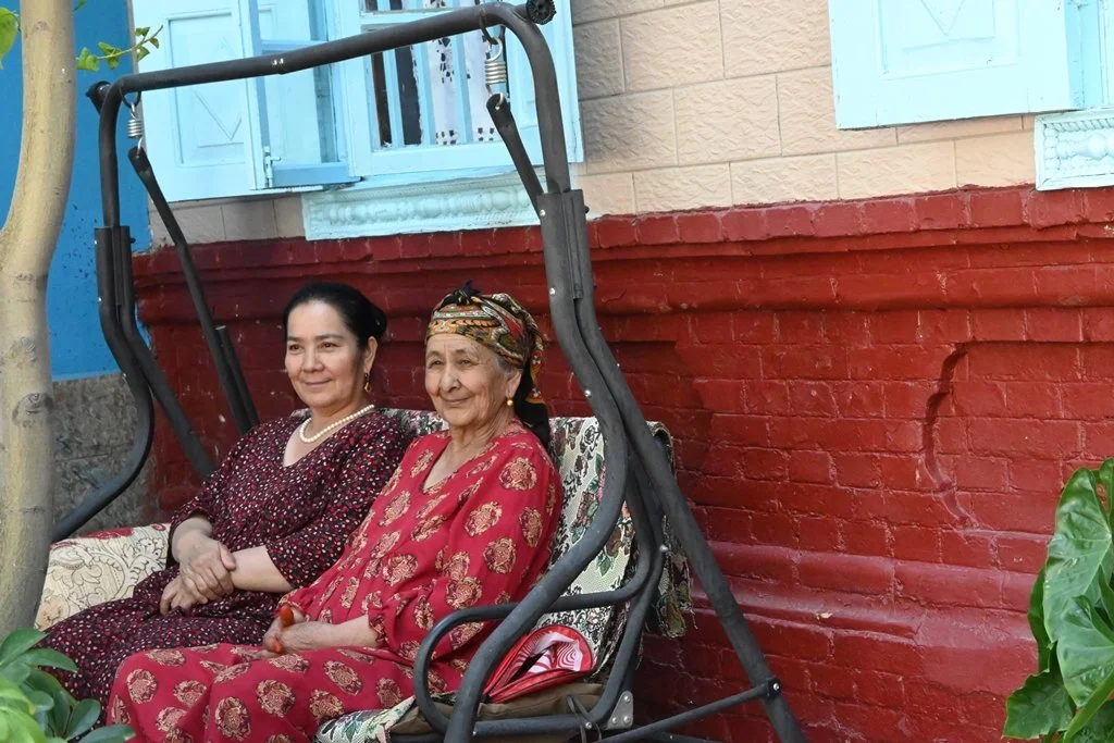
Kazanqi Folk Tourism Area - Uyghur Home Visit

Kazanqi Folk Tourism Area - Performance
Getting Back: High-Speed Train from Yining to Urumqi
We returned to Urumqi by high-speed train — a five-hour journey. What struck me was the number of people boarding without seat reservations, buying standing tickets and settling onto the floor of the connecting sections or wherever an empty seat appeared. It’s a particular kind of Chinese travelling culture that I hadn’t seen in a while.
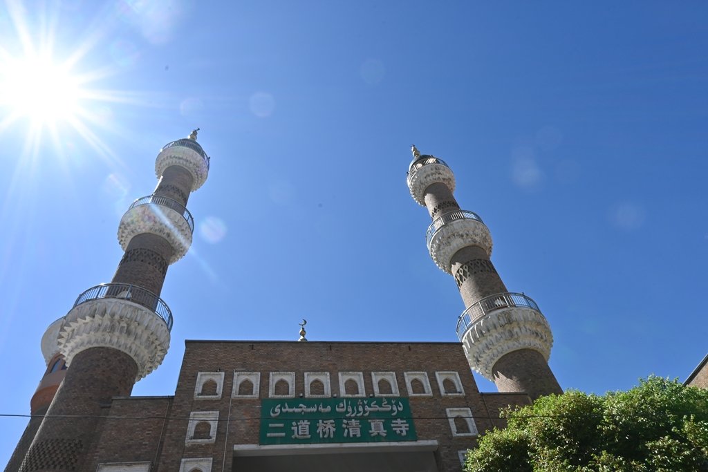
Back in Urumqi, the International Grand Bazaar was the last stop of the trip — a 40,000 square metre complex of Islamic-style domes and minarets. It’s the place to buy Xinjiang carpets, dried fruits, nuts, Hetian jade, and Nang flatbread. Even if you’re not shopping, it’s worth walking through.

International Grand Bazaar
International Grand Bazaar - Mosque

International Grand Bazaar - Nang flatbread

International Grand Bazaar - Souvenirs
International Grand Bazaar - dried fruit

International Grand Bazaar
The Food Worth Knowing About
Xinjiang food is not what most people associate with Chinese cuisine. Lamb is everywhere — grilled, stewed, skewered. Beef is common. Pork is largely absent given the Muslim majority. Nang flatbread appears at almost every meal.
The snacks unique to the region are worth seeking out: dried apricots stuffed with walnuts (exactly what it sounds like, eaten like a small sandwich), dried nuts and fruits of unusual variety, and cheese products made from goat, cow, or camel milk.
One more thing: the Xinjiang cow milk ice cream, available at most convenience shops along the route. It has a slightly sour, smooth texture that is nothing like commercial ice cream. I’m glad I tried it.

Is Northern Xinjiang Worth Visiting?
Yes, with clear expectations.
This is not an easy trip. The distances are long. The conditions are harsh. And the surveillance is something you carry with you the entire way. If you’re expecting a smooth, comfortable, curated travel experience, Xinjiang will push back against that.
But if you're drawn to places that feel genuinely different, Northern Xinjiang delivers in ways that are difficult to explain until you've been there. The landscapes don't look like anywhere else. The culture carries centuries of complex history. And there's a particular feeling of being far from familiar ground that I still haven't fully shaken.
The bare land between the destinations is not empty. It just takes a while to understand what it’s full of.
FAQs
Is Northern Xinjiang safe to visit?
Xinjiang is open to foreign tourists, and many people visit each year. The region has a very visible security presence — police checkpoints, surveillance cameras, and security checks at petrol stations and certain public areas. Travellers should be aware of this before going. Joining an organised tour is the most practical approach for navigating the checkpoints and language barrier, especially outside of Urumqi.
Is Northern Xinjiang high altitude?
Altitude varies significantly across the region. Sayram Lake sits at approximately 2,073m above sea level, while Kanas Lake is around 1,374m. The mountain passes between destinations can reach 3,000m+. Altitude sickness is unlikely at most key sites, but the long drives at elevation mean acclimatisation matters if you're sensitive.
How do you get around Northern Xinjiang?
Most visitors travel by organised tour, which is also the most practical option given the distances involved (cities are often 5–10 hours apart by road) and the multiple security checkpoints that require coordination. Independent travel is possible but significantly more complex. Within Urumqi, a high-speed rail connection to Yining (5 hours) is a good option for the return leg.
What is Northern Xinjiang known for?
Northern Xinjiang is known for its alpine lakes (Kanas Lake, Sayram Lake), birch forest scenery in Hemu Village, the wind-eroded rock formations of Urho Ghost City, Tuvan nomadic culture, and the vast dry steppe landscape that covers most of the distance between destinations.
What should I pack for a trip to Northern Xinjiang?
High-factor sunscreen and UV-protective clothing are essential — the UV intensity at altitude is significant. Layers are important as temperatures can swing dramatically between day and night, particularly outside of summer. Comfortable walking shoes are necessary for sites like Kanas, where you may climb over 1,000 steps. A basic offline translation app helps given the Mandarin-dominant environment in many areas.